Optimization of the tourist orientation and visitor guidance system Leiser Berge
Content
The further development of the Leiser Berge to make better use of the tourism potential in soft tourism.
Adapt the brand "Leiser Berge" and the visual appearance to the CI Weinviertel.
Consolidation and presentation of the excursion destinations, gastronomy, accommodation, etc. in the form of regional and community boards, a printed map and in digital form.
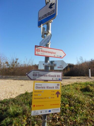
Equip the routes of the Mountain Bike Arena Leiser Berge with directional signs.
Measures
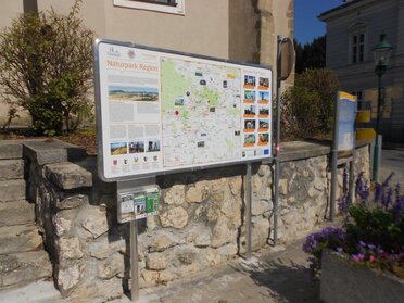
Production of 16 pieces of regional overview panels, 2m wide x 1m high and 17 pieces of community charts in the same size and installed at selected locations.
The orientation and visitor guidance system provides a comprehensive overview of the offerings of the entire region and the infrastructures of the respective communities.
Make and set up 350 pieces of signs on the MTB routes.
Production of a leisure map for visitors on site and for the promotion of the nature park region Leiser Berge (Ferien Messe Wien, events, etc.).
Implementation via QR code in digital form on the region platform Leiser Berge.
Target
To give the visitors an overview of all offers (excursions, attractions, restaurants and accommodation, hiking and biking trails, etc.) of the nature park region Leiser Berge.
At best, the guest visits other offers or comes back and stays a few days.
The main objective is to promote sustainable tourism and increase added value.
Projektträger: Regionalentwicklungsverein Leiser Berge, Ernstbrunn
Projektlaufzeit: 24.11.2016 - 29.11.2018
Download: Projekt-Factsheet
weitere Informationen: hier klicken
Ein Projekt stellt sich vor
Ein Projekt zieht Bilanz


